
Well Permit Verification
Overview
Under the Yolo County Board of Supervisors Ordinance No. 1569 – “An Urgency Ordinance Temporarily Extending Certain Requirements on the Issuance of Agricultural Water Well Permits in the Unincorporated Area of Yolo County Pending completion of Long-Term Well Ordinance Amendments”, the YSGA will continue to coordinate with Yolo County in reviewing new well permits. This review does not apply to domestic wells extracting less than 2 acre-feet per year; wells used for public water systems; monitoring wells or wells not intended for groundwater extraction; minor alterations of production wells that do not significantly alter the depth interval that groundwater is extracted from or increase the discharge rate for the well; and persons falling under the hardship exception.
Yolo County Division of Environmental Health (DEH) is the permitting agency for groundwater wells, and applications should be submitted to DEH as normal. Yolo County Environmental Health Water Well Program
In order for DEH to issue a well permit, the YSGA must send written verification that groundwater extraction by the proposed well:
- would not be inconsistent with any sustainable groundwater management program established in the Yolo Subbasin Groundwater Sustainability Plan AND
- would not decrease the likelihood of achieving a sustainability goal for the Yolo Subbasin.
YSGA Permit Review Procedures
To provide this verification, YSGA has updated procedures and criteria for use in reviewing well permits. Below is a flowchart outlining the process.
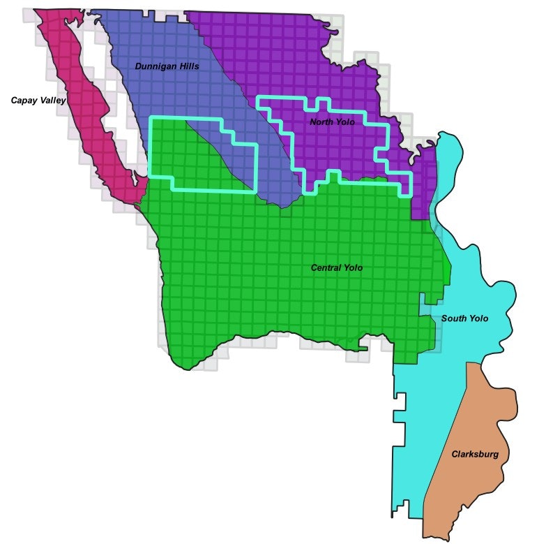
Focus Areas
The Focus Areas are areas in the Yolo Subbasin in which well permit applicants that are not exempt from the Urgency Ordinance will be required to submit additional information for the YSGA to review. Well permits submitted within a Focus Area will go through the Tiered Review Process described below.
The Focus Areas map was prepared using various hydrologic data, reported citizen concerns, and professional judgement to delineate areas in the Yolo Subbasin that may be sensitive to groundwater pumping and warrant additional information and analysis.
Interact with the Focus Areas map below, or Click here for the full version
Tiered Review Process
This process applies to well permit applications inside the Focus Areas only.
Tier 1 – YSGA completes a hydrogeologic evaluation and impact assessment of the well design and details provided by the well applicant in the Tier 1 Analysis Form. This will include extracting aquifer properties from the YSGA’s Groundwater Model unique to the location and depth of the proposed well, and an assessment of groundwater level impacts using analytical methods.
- If there are no sustainability concerns identified in respect to impacts on groundwater levels at nearby monitoring wells, water quality, interconnected surface waters, and land subsidence, then the YSGA will provide Yolo County Division of Environmental Health with written verification for the well permit application.
- If there are sustainability concerns identified by any of the above indicators, then the YSGA will request that the applicant advance to Tier 2 and complete a Hydrogeology Report.
Tier 2 – YSGA will request the applicant focus the Hydrogeology Report on the sustainability indicators of concern and relate the analysis to the Yolo Subbasin GSP sustainable management criteria and minimum thresholds. Additionally, a Professional Geologist or Certified Hydrogeologist will certify that the proposed well complies with the guidelines set forth in the Urgency Ordinance.
- If the prepared report provides evidence that alleviates the concerns around groundwater levels, water quality, and/or subsidence that arose in Tier 1, the YSGA will issue written verification of the well application.
- If one or more indicators remain a concern to the YSGA, the YSGA will document these concerns and request a meeting with the well applicant to discuss options to bring the well into compliance with the EO.
The Full Technical Memo outlines the requirements and components of YSGA permit review within the Focus Areas.
Well Completion Report Data Update for Hungry Hollow and Yolo Zamora
YSGA staff recognize there are data gaps within the Yolo Subbasin. To fill in data gaps, YSGA staff have downloaded all available completion reports (WCRs) throughout the entire subbasin from DWR’s Online System for Well Completion Reports (OSCWR). Using these WCRs, the YSGA is updating the YCFCWCD (District) WCR database. The District database has not been updated since the 2000s and is currently reliant on OSCWR for the accuracy of where each of the WCRs are spatially located. OSWCR is known for not assigning the location of WCRs with a high degree of certainty and often assigns WCR locations to the center point of the Township Range Section, especially if it’s an older WCR. Through efforts to better understand the hydrogeologic conditions in Hungry Hollow, YSGA staff recognized that there are now significantly more WCRs available than what had been captured in the District’s database. This data is being compiled to do the following:
· Spatially locate with greater accuracy than OSCWR where each WCR is located
· Extract all relevant well information from each WCR and assign that data to the proper WCR location
To get this effort started, YSGA staff completed this exercise for all WCRs in the Hungry Hollow and Yolo-Zamora areas (Map 1) and used this data to develop detailed, draft hydrogeologic cross sections to better understand the subsurface lithology and groundwater dynamics. This will be done throughout the entire subbasin to update the hydrogeologic conceptual model for the GSP and the Yolo Subbasin Model over the next three years. By completing this effort, YSGA staff anticipate developing a much more detailed understanding of the Yolo Subbasin groundwater dynamics and, in turn, develop a much more effective model that will be useful for developing and evaluating potential implementation of project and management actions with a greater degree of certainty.
This data may be useful to landowners considering drilling a well and for geologists/hydrogeologists preparing a YSGA Tier 2 Hydrogeologist Report (or Yolo County Department of Environmental Health Hydrogeologist Report) for a well in these areas. Please click the links below to download data within the area of interest:
***Note data and interpretations are considered DRAFT and are subject to modification and change at any time***
Map 1:
Resources and Documents
- Focus Areas Map
- Tiered Review Process Flowchart
- Tiered Review Process Technical Memo
- YSGA Permit Review Procedures - Adopted March 18, 2024, updated November 18, 2024
- Yolo County Environmental Health Water Well Program
- YSGA Resolution 22-01, adopting well permit review procedures
- YSGA Resolution 22-02, adopting well permit review fees
- YSGA Resolution 23-01, directing the preparation & implementation of updated well permit review procedures
- Yolo Subbasin Groundwater Sustainability Plan
More questions? Contact wellpermits@yolosga.org